Showing posts with label Ordnance Survey. Show all posts

Wednesday, 9 March 2011

Ordnance Survey request help on data usability

EDINA has been asked to post the following request for assistance from Ordnance Survey regarding the usability of particular datasets. Please follow the links below if you can help.

You may remember a similar survey being conducted in June 2010. This latest survey refers to different datasets.


Hello,

My name is Michael Brown and I work for the Ordnance Survey research department. My work includes the development and application of methods to improve the usability of OS products. I am currently exploring the use of questionnaires to evaluate the usability of our products and guide their further development. If you have any experience of the following Ordnance Survey products please follow the links provided and complete the questionnaire. Each should only take a few minutes to complete, and I would appreciate it if you could complete as many as you can.

OS MasterMap® Integrated Transport Network Layer™
http://www.surveymonkey.com/s/OSMM-ITN

OS MasterMap® Topography Layer
http://www.surveymonkey.com/s/OSMM-Topo

OS OpenData™ Boundary-Line™
http://www.surveymonkey.com/s/OSOD-BL

If you have any questions feel free to contact me. Thank you for your time.

Dr. Michael Brown
Usability Specialist
Research, L1F2, Ordnance Survey
Adanac Drive, SOUTHAMPTON, United Kingdom, SO16 0AS
michael.brown@ordnancesurvey.co.uk

Friday, 12 November 2010

Digimap for Schools launched

Baroness Joan Hanham CBE, Parliamentary Under Secretary of State for Communities and Local Government (CLG) has launched a brand new service to help improve the teaching of geography in schools with Dr Vanessa Lawrence CB, Director General and Chief Executive of national mapping agency Ordnance Survey. The launch took place at Graveney School in Wandsworth, London on Wednesday 10 November at 2pm.

Ordnance Survey is increasing its support for the teaching of geography at all levels by launching a brand new online mapping service for all schools across Great Britain. 'Digimap for Schools' provides schools with easy access to Ordnance Survey's most detailed digital mapping for the whole of Great Britain. For the first time, pupils will have access to maps showing individual building outlines as well as familiar scales of mapping used by outdoor enthusiasts and on websites.


[full story - Ordnance Survery News Release]

Friday, 1 October 2010

NEW open service: Digimap OpenStream

EDINA is pleased to announce the release of Digimap OpenStream – a web service delivering OS OpenData to the UK academic sector using open standard WMS technology.

Digimap OpenStream is an EDINA Digimap value-added service freely available to the academic community. Access is not restricted to registered Digimap users, although a one-off online registration is required. The OS OpenData offered is accessible 24/7 and users are able to embed it into their own application software without the overheads of downloading and managing large quantities of data.

Digimap OpenStream provides access to the following OS OpenData products:

  • MiniScale®
  • 1:250,000 Scale Colour Raster
  • OS Vector Map™ District (Raster)
  • OS Street View®

Details of the Application Programming Interface (API) are provided along with simple guides illustrating how to use the service within popular GIS software.

Full details of the Terms and Conditions of Use can be found now at http://openstream.edina.ac.uk/terms


Monday, 28 June 2010

Data Usability - request for help

EDINA has been asked to post the following request for assistance regarding the usability of geographic information. Please follow the links below if you can help.


Hey Everyone,

My name is Michael Brown; I'm working with the University of Nottingham in conjunction with Ordnance Survey to develop a set of User Centred Design Tools for use with Geographic Information.

As part of this I am currently working on a questionnaire for the measurement of the Usability of Geographic Information. The next stage of this process is to validate the questionnaire by getting people to complete it, focusing on a few specific products. This will allow me to calculate how well it differentiates between different GI data sets as well as providing useful information about the products that will be fed back to Ordnance Survey.

I'm focusing this validation on 3 products.
  1. OS MasterMap- Topography: http://www.surveymonkey.com/s/OSMMtopo
  2. OS MasterMap- Imagery: http://www.surveymonkey.com/s/OSMMimagery
  3. OS 1:50,000 Scale Colour Raster: http://www.surveymonkey.com/s/50kRaster
If you have any experience with any of these products, I'd appreciate your help. Please follow the relevant link(s) and complete the questionnaire(s). This version is fairly short and should take less than 5 minutes to complete.

Feel free to complete more than one of them and please forward this on to anyone you think might be able to help me collect responses. If you have any questions, please feel free to contact me at: michael.brown@ordnancesurvey.co.uk

Thank you for the help

Michael

Monday, 5 April 2010

OS OpenData

EDINA welcomes the release of Ordnance Survey datasets for free use and re-use. We are actively working to realise to the full the opportunities offered by this new policy for the enhancement and development of new and existing services for research and education.


As many will already know the Government published details on 31 March 2010 of the package of datasets and products from Ordnance Survey that are now available under OS OpenData - see http://www.ordnancesurvey.co.uk/oswebsite/opendata/. The list coincides partially with the datasets currently available through EDINA Digimap – see below. Note especially that OS MasterMap, the large-scale vector data, is only available through registration with EDINA Digimap.


The key task for EDINA Digimap is to provide ease and continuity of access to a whole range of geo-spatial datasets, including re-use in materials that are shared in research and teaching. We are therefore seeking clarification from Ordnance Survey regarding the licence terms that can now apply to the data available through Digimap which are now covered under OS OpenData.


The release of many Ordnance Survey datasets as open data is also good news for Unlock, the EDINA service which is there to help you geo-enable research data and other Internet-accessible documents and images. Unlock, and its predecessor GeoCrossWalk, were previously limited by license to academic use only. Relevant datasets now regarded as open data, including Boundary-Line, Code-Point® Open and the 1:50 000 gazetteer of place names, can now be used by Unlock Places, Unlock Text and Unlock Geocodes.


We are keen to learn from users of Digimap how you wish us to take best advantage of these changes in availability and licensing. Contact us by email on edina@ed.ac.uk or leave a comment on this blog.


Product Name

EDINA Digimap

OS OpenData
OS MasterMap TopographyYesNo
OS MasterMap ITNYesNo
1:10 000 Scale RasterYesNo
nearest equivalent is OS StreetView
1:25 000 Scale Colour RasterYesNo
1:50 000 Scale Colour RasterYesNo
1:250 000 Scale Colour RasterYesYes
MiniScale®YesYes
Meridian™2YesYes
Strategi®YesYes
Land-Form PANORAMA® ContoursYesYes
Land-Form PANORAMA® DTMYesNo
Land-Form PROFILE®YesNo
Boundary-Line®YesYes
Code-Point®YesNo
CodePoint® with PolygonsYesNo
Code-Point® Open
(point data only; subset of Code-Point®)
NoYes
1:50 000 Scale GazetteerYesYes
OS StreetViewNo
nearest equivalent is 1:10 000 Scale Raster
Yes
OS LocatorNoYes
OS VectorMap District
(from 1 May 2010)
NoYes

Wednesday, 31 March 2010

New Products added to Data Download

MiniScale and 1:250 000 Raster data are now available in Digimap's Ordnance Survey Collection Data Download facility.

The datasets have been available from the ShareGeo service for some time, but are now also available from within Digimap. In addition to the new products you can now also:

  • download the OS Land-Form PROFILE, 1:10 000 Contour data in DXF format
  • download Shapefile and MID/MIF versions of Meridian2 data

The new Meridian2 formats have their own entry on the Product & Format page of Data Download. These formats are available as national coverage, with a single download covering the whole of Great Britain. The NTF and DXF formats are still available as individual tiles.

Land-Line style maps available in Carto

Maps of OS MasterMap data in Carto can now be styled to look like previous Land-Line.Plus maps. This is particularly useful for black and white printing or to recreate Land-Line.Plus data for comparison with older printed maps.

Tuesday, 22 September 2009

2009 Annual Data Update

New data
On Thursday 17th September EDINA released all available updates for data provided through Digimap's Ordnance Survey Collection. Details of the versions of all the data offered can be found on the EDINA website here. The Digimap licence also now offers MiniScale and the OS 1:250,000 scale colour raster data. These are currently available through ShareGeo and will be added to the Data Download as soon as possible.

Architectural Changes
As well as updating the data, other significant changes have been made to the underlying technologies supporting Digimap. In short, we have replaced the entire GIS architecture which produces the maps you see online.

The new software, from Cadcorp, offers a number of benefits to both EDINA and end users of Digimap. As well as enhanced quality maps and faster map generation online, the printed output gives crisp, clear maps as PDF files. EPS files are no longer available from any facility within Digimap's OS Collection, including Carto, but EDINA is working on the provision of additional formats to PDF.


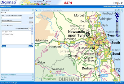
New mapping facility: Roam
With the arrival of the new GIS software, EDINA has also developed a new mapping facility, called Roam. Still in a development phase, Roam offers the usual search functions as well as "slippy maps", the click-and-drag function used to position a map, familiar to users of other popular online mapping facilities. It is easier to locate your map, easier to zoom in and out, and now offers maps at 12 different fixed scales. An additional small scale Ordnance Survey mapping product, MiniScale, has been included, and other datasets (e.g. Strategi and OS MasterMap) are available at more than one fixed scale.


Currently Roam is available as a Beta facility to site representatives only until Monday 5th October, when it will become available to all registered users of Digimap's Ordnance Survey Collection. Roam is available from the OS Collection Home page; you will find the new icon next to those for Classic and Carto. It will be greyed out if you don't yet have access to it.

Roam will run in Beta alongside the current Classic facility until January 2010 when Classic will be withdrawn entirely. Regular updates will be made to Roam to add new functionality, such as MyMaps, prior to its release as a full service in January 2010.

If you have any questions about this email or about Digimap in general, please do not hesitate to contact the EDINA Helpdesk on edina@ed.ac.uk

Friday, 4 September 2009

Reminder: OS Collection Licence Renewal

Remember that you need to renew your institution's subscription to Digimap's Ordnance Survey Collection BEFORE 30 September 2009 in order to ensure continuity of service.

If your institution has not completed and returned the appropriate licensing forms by this date, access to Digimap's Ordnance Survey Collection will be removed.

Owing to the way access is controlled under the UK Federation there will be no exceptions to and no leeway given for this date. If you have already requested an invoice, you still need to return the subscription forms to the address supplied on the forms by 30 September 2009.

Should you have any questions please contact either JISC's Subscription Agent (subscriptionshelp@jisc.ac.uk) or the EDINA Helpdesk (edina@ed.ac.uk)

Friday, 7 August 2009

Ordnance Survey Licence Renewal

On 1 August 2009, the Ordnance Survey Data Sub-Licence Agreement was extended and amended by a Variation Agreement. If institutions wish to continue their subscription to Digimap's Ordnance Survey Collection, the Variation Agreement must be signed and returned by Wednesday 30 September 2009. Institutions not submitting renewal forms by this date will have access to the service removed. There will be no exceptions to this. Details of how to re-subscribe are given on the JISC Collections website.

When an institution re-subscribes to Digimap's Ordnance Survey Collection, it agrees to the terms of the Ordnance Survey Data Sub-Licence Agreement AND the Variation Agreement. Some of the clauses in the Sub-Licence Agreement are superseded by those in the Variation Agreement. Both documents must be read in conjunction with one another, since one is not valid without the other.

EDINA has drawn up a set of Frequently Asked Questions to help you understand what the the Sub-Licence and Variation Agreements will permit in terms of map and data usage. These can be found at: http://edina.ac.uk/digimap/support/faq_oslicence.html


The following is a summary of the changes which are brought into effect on 1 August 2009 by the Variation Agreement. The original Sub-Licence Agreement holds good unless it has been amended by the Variation Agreement. Please read the Variation Agreement itself for full details of the amendments.


  1. The definition of Authorised User has changed. An individual must fulfill three conditions in order to be an Authorised User. Individuals must:
    1. be a student of, staff (both current or retired) of, or visitor to an Authorised Institution
    2. be authorised by an Authorised Institution to access the Authorised Institution's electronic information services via secure authentication; and
    3. be registered with EDINA Digimap

    Overseas Students are also specifically excluded from being Authorised Users, unless they are resident within the UK. Check the wording of the Variation Agreement carefully. Note also that it is the institution's responsibility to ensure that students who are not eligible for access to this service are not given the means to access it. Under the UK Federation, EDINA is not able to check eligibility.

  2. All references to Athens have been superseded by references to the UK Access Management Federation.

  3. Class Registration is no longer possible. This has been the case since the introduction of the UK Access Management Federation in August 2008, but has now been formalised in this Variation Agreement. Assigning one username to more than one individual (as per a Class registrations) is not permitted under UK Federation policy.

  4. Authorised Users are now explicitly permitted to share data with other Authorised Users, either in the same or another Authorised Institution. This was previously implicit, but has now been made explicit. Sharing data between Authorised Institutions is still subject to completion of the Transfer of Data form as specified in the original Sub-Licence Agreement (Schedule 7, section 8.1)

  5. The Permissible Publication Sizes have been amended. These now offer a significant improvement on the previous restrictions to the size of maps published. For example, it is now possible to publish a map of Great Britain in electronic format. Please read Schedule 2 of the Variation Agreement for specific details of the new rules.

  6. Two new datasets have been included in the agreement: MiniScale® and the 1:250,000 Scale Colour Raster. A full list of products available can be found on the EDINA website.

Both the Sub-Licence Agreement and the Variation Agreement are available from EDINA's website:

Questions regarding the subscription process and the licence agreements should be directed at JISC Collections. Questions relating to the Digimap service should be directed at the EDINA Helpdesk.

Monday, 8 December 2008

Win a prize worth £1750!!

Are you using Ordnance Survey data in an innovative way? If so, enter the competition and you could win a prize!

EDINA and Ordnance Survey are pleased to announce a competition to find the most innovative use of Ordnance Survey data. To enter the competition you need to submit a summary of your work which describes what you were trying to achieve, what Ordnance Survey data you used (and how), what makes the work and the use of the data innovative, and how the data could be improved to make the work easier, or to have made more possible.

Full competition details
Full details of the competition can be found here. Please ensure you read this document carefully before submitting your application.

Grand Prize
The winner will receive £250 of Amazon vouchers to distribute amongst project colleagues plus travel, accommodation and conference fees for one or more researchers, up to a total value of £1,500, to a conference of your choice. There are second and third prizes of £250 and £100 in Amazon vouchers.

Closing date
The closing date for entries is midnight on Saturday 31st January 2009. Entries may be submitted by email or on paper.

Questions
All questions regarding the competition should be addressed to Ordnance Survey directly, on universityenquiries@ordnancesurvey.co.uk


Good luck!